PARKING
There is plenty of free, off-street public parking in downtown St. Ignace behind our main street, State Street. This parking area allows you quick access to our downtown retailers and eateries, plus ferry lines, and St. Ignace Trolley stops.
State Street Parking
Two-hour parking is available along State Street. Perfect for quick shopping trip or grabbing a bite to eat or an ice cream cone, this free parking is clearly marked.
City Hall
Parking is available behind St. Ignace City Hall via Goudreau Avenue. This street leads you up to the St. Anthony’s Rock parking area and an abundance of free public parking spots.
St. Anthony’s Rock
Parking Area Located behind State Street, this parking area can be accessed from Central Hill or Truckey Street, and is convenient for downtown shopping, strolling the Huron Boardwalk, or catching one of the ferries to Mackinac Island.
St. Ignace Marina
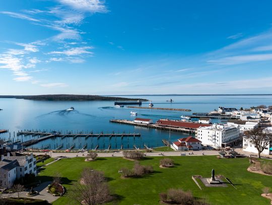
Public parking is also available near the marina. This is a great spot to park if you’re looking to watch the boats come in, stroll the boardwalk, cast a line, or check out the Wawatam Light and historic Chief Wawatam dock, which is now a public park.
SHUTTLE & TAXI
Northern Transport and Shuttle
906-430-5537
Straits Area Taxi
906-643-6666 – 24 Hour Transportation Service, Serving All Northern Michigan Airports, Casinos, Hospitals, and Mackinac Island Ferries, Medical Transportation.
Our Family Share a Ride
906-298-2527
Bicycles have a big presence here. Be on the look out while traveling. Besides walking, the bicycle is the favored mode of transportation on nearby Mackinac Island, so you’ll see riders coming and going from the ferry docks frequently. We are also a designated Trail Town on the North Country Trail and on the route of several bike tours, which means bicycles will be sharing the road way with you.
EUP TRAVEL TIPS
• Bring a paper map or take screenshots of your map.
Cell phone service can be spotty to non-existant in certain areas of the E.U.P., making it risky to rely on your smartphone alone.
• Bring a fully charged power bank and your charging cable.
Roaming and searching for a GPS or data signal can drain a smartphone battery quickly.
• Call ahead and make reservations.
We might be sparsely populated, but we are pretty popular. While you may be able to find accommodations without planning ahead, on weekends, especially during our big events, it’s risky to just head north without a confirmed reservation.
• Pack for the ever changing weather.
Temperatures can fluctuate, especially along the lakeshores. Dress in, or bring layers. Also, if you’re going exploring or adventuring, pack extra shoes and socks in case things end up little more rugged than you planned..
• Bring snacks, water, blankets, tarp, etc.
Should you end up stranded in your car, or on a trail, you will want to be prepared to spend a day or even night possibly in the wilderness.
• Get gas and use the restroom when you can.
Gas stations can be few and far between once you get into the heart of the E.U.P. Also, if you think you should use the restroom when you’ve stopped to fill up, that means you probably should. Not only are gas stations limited, but rest areas are as well.
PLACES OF NOTE
Brevort Lake / Hiawatha National Forest From St.
Ignace: From the intersection of US-2 and I-75, head WEST on US-2 for approximately 17 miles to Brevort Camp Road (Forest Service Road 3108). Turn RIGHT (north) and travel 1.2 miles to the campground entrance (Forest Service Road 3473). Turn RIGHT (northeast) onto FR3473. The campground site is 1/2 mile down FR3473.
Doc Holle’s Silver Mountain Recreation Area
Featuring disc golf in the spring, summer, and fall, and tubing in the winter, this recreation area is located at the corner of US-2 and Cheeseman Road. While easy to find, it’s also easy to miss when traveling at highway speeds. Coming from St. Ignace, once you pass the Gros Cap Roadside Park, slow down a bit as Cheeseman Road will be on the right about 2 miles down the road. The shoulder is paved as a turning lane, so put on your right blinker and turn RIGHT onto Cheeseman Road. Almost immediately, you’ll see the signs for Doc Holle’s and you’ll turn RIGHT into the parking area.
Mackinac Straits Health System
From the South/Downtown St. Ignace: Take Exit 344A off I-75 N and turn RIGHT onto State Street. Follow State Street through downtown St. Ignace. There are signs for the hospital along the way, and you will turn LEFT into the hospital’s campus off of North State Street. From the North: Take Exit 348 (Castle Rock) off I-75 S and follow I-75 Business Loop/State Street into town. There are signs for the hospital along the way. You’ll want to turn RIGHT into the hospital’s campus off of State Street.







Comment
Comments